|
Visite virtuelle de la route de la Baie-James
Page 6 de 12
Page précédente
Page suivante |
|
|
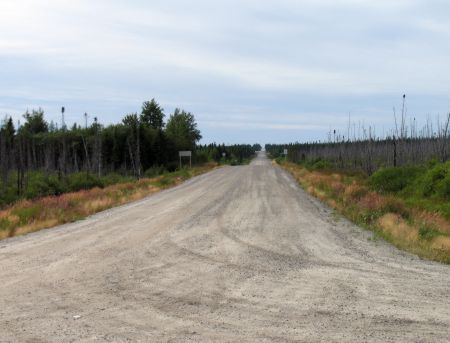 |
Km
237: Junction with Waskaganish Road.
Waskaganish
is a Cree village located 102 km to the west at the
mouth of the Rupert River. The road is unpaved and was
opened in August 2001.
Click here
for more info. |
|
| Km 244:
Fishing site Km 247: Emergency telephone ("Randal")
Km 252:
Fishing site |
 |
Km
257: Rupert River campground, 1.2 km east of the
Road. Boat launching ramp, fishing picnic tables,
toilet, no shelters. This is a very basic campground,
little more than a parking lot. It's also a pull-out
place for canoes and kayaks who are heading downstream.
The rapids downstream are impossible to negotiate and
are deadly. Be aware of this if you put your boat in
here. At least 2 people have
been killed by these enormous rapids. They got "swallowed" by the rapid,
hence the name, Oatmeal Rapid. |
|
|
Km 257:
RUPERT RIVER
DEFINITELY STOP HERE AND TAKE A LOOK |
|
 |
THIS IS A MUST-SEE! Stop here to view this huge wild northern river's spectacular rapids and falls
(Kaumwakweuch Rapids; also known as Oatmeal Rapids).
Toilets, picnic tables, shelters, scenic viewpoint.
The compound on the west side of the Road here is an SEBJ
camp, now re-opened (March 2005). Some lodging available ($110 per
night), cafeteria, limited supply of gas for emergencies, garage for
do-it-yourself repairs with an air compressor.
The rapids/falls are known as Oatmeal
Rapids, and as Kaumwakweuch Rapids on the topo maps.
A hiking trail follows the north bank upstream to a viewpoint -- cross the
Rupert River on the bridge and follow the trail upriver on the north
side. Part of the north shore was burned by a forest fire in the summer
of 2002, so the trail is closed past the first viewpoint. But if you
wish to walk further upriver at you own risk, you will be rewarded by a
couple more places to get close to the
Rupert River rapids and experience up close the full power and majesty of
this wild river. This is in fact the old portage trail,
probably in use for thousands of years by the Crees. Part of the ancient
trail is now buried under the road. Going upstream, the trail leads to
the beginning of the portage, it was never "officially" closed. This is
about 1200m. Downstream, the trail leads to the end of the portage -
very tricky going down there.
The Rupert River is different upstream vs. downstream from the bridge.
The scenery and vegetation are very different. Upstream it is sandy and
rocky. Downstream it is mostly rocks and clay. Sometimes in high water,
the bridge is almost the limit for drinking water from the Rupert.
According to some,
the Rupert River water is pure and perfectly drinkable without any
treatment. |
|
 |
|
This spectacular sight may be no more by 2007. For
more info on the threatened Rupert River visit the
Rupert
River website.
A few photos of this magnificent river are presented
here on this page. There are LOTS more photos, and movies, of this
river in the Rupert River website. |
|
 |
|
|
 |
The Rupert River bridge. |
|
 |
Another view of the
bridge. |
|
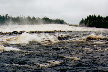 |
The rapids |
|
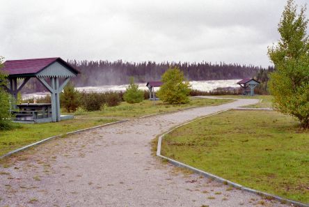 |
The picnic area overlooks
the spectacular rapids (seen here in the background). |
|
|
 |
 |
A view from the bridge. |
|
|
|
 |
Another view from the
bridge. Hey ... if you don't stop and get out to look
and experience the Rupert River, at least slow down on
the bridge and have a look out the car window!! |
|
|
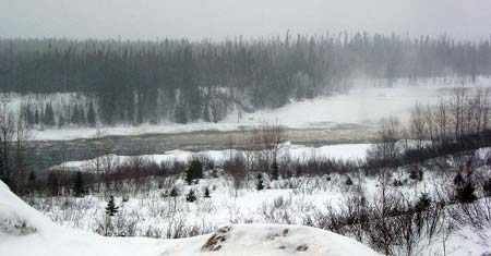
Photo by "Peter (uptick)" |
Here's a couple of photos
of the Rupert River in the winter.
CLICK HERE
for more photos of the Rupert in winter. |
|
|
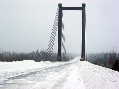
Photo by "Peter (uptick)" |
The Rupert River bridge in
winter. CLICK HERE for more photos of the Rupert in winter. |
|
| |
| For LOTS more photographs (and movies) of this spectacular
river and rapids, please go to the
Rupert River website. |
|
|
|
Page précédente
Page suivante |
|
|


