|
Visite virtuelle de la route de la Baie-James
|
|
|
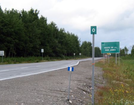 |
Km 0:
Beginning of the James Bay Road, just outside Matagami
-- the start of
your remote highway adventure! "Matagami" is a Cree word meaning "where the waters
meet".
This is the last town you'll
see for 620 km (375 miles)!! Stock up on what you need for the trip, especially
gas. There's only one gas station between here and the end of the
road. The Shell station (the first one you encounter on your way in to town)
is open 24 hrs, 7 days a week. There's a basic store here as well where
you can get ice, some groceries, and other things. In Sep 2005 gas
was $1.21 per liter, and diesel was $1.07 per liter. But this was in the
aftermath of Hurricane Katrina, when gas prices went a bit nuts.
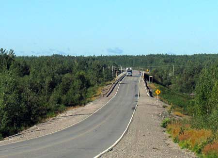
You may encounter logging trucks through km 200 or so.
The James Bay Road is reached via
Hwy
109.
|
|
 |
Km 0: "Route de la
Baie James" -- The James Bay Road. |
|
 |
Km 2: Bell River. This is the longest
bridge on the James
Bay Road. The Bell
River flows into Matagami Lake. The northern part of the lake then becomes
the Nottaway River which flows north to James Bay.
This is
the first of the large rivers that you will cross. |
|
| Km 6: Junction with bush road R1005, just south of the
Checkpoint, running east from the road. This bush road leads south &
east to
Lebel-sur-Quevillon on Hwy 113. |
 |
Km 6: Checkpoint:
Stop here and register.
Due to the remoteness of this road, you must stop here
and register your travel plans. Open 24 hrs, 7 days per
week.Tourist information, maps, souvenirs, restrooms, picnic
tables, shelter, telephone. You can also register for tours of the
hydro-electric power installations of Robert Bourassa and LG-1, and make
reservations for hotel rooms in Radisson & Chisasibi. Open 24 hours, all year 'round. (819) 739-4473. You are
strongly urged to register here, due to the remoteness of the country
through which you will be passing.
Information panel: "One territory ... six seasons".
|
|
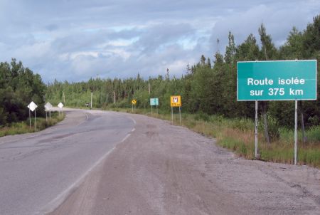 |
Km 6: "Isolated
Route for 375 km". From here on, you will see diminishing
amounts of traffic, and only a handful of buildings over
the next 375 km. |
|
 |
Km 6: Just beyond
the checkpoint. No gas for 375 km. This sign is not a
joke! There really is no gas or fuel of any sort for
375km! Nor any services. |
|
 |
Km 6: It's a long
way to anywhere. |
|
 |
Km 8:
Mont Laurier
comes into view. There is a network of hiking trails
there, including one to the top of the mountain. |
|
 |
Km 8: Strung out at
various locations along the Road are these "Information
Panels." Each one describes a different aspect of the
country and the Road. Unfortunately, they are all in
French and Cree, not English.
This one is about Bogs and Fens, of which there are a
lot in the part of the world. |
|
|
 |
Km 10:
Mont Laurier
trail, to the west of the Road. You can climb to the
top via trails and enjoy a magnificent view of
Matagami's
surroundings.
There is a network of trails surrounding the hill,
and extending to km 12 & km 18. A straight hike up
and back would take about 1.5-2 hours. Note that it is a
lot farther and higher than it looks from the road. The
trail starts at the "Telebec
Laurier" sign and is directly across the road from the Information
panel.
This photo shows the start of the trail. It climbs by
a roundabout route to the microwave tower at the top of
the mountain, seen here in the distance. Don't block the
gate when you park here. |
|
Well, it's not really a "mountain", but it sure seems
like it from the top! The top of the hill is at an
altitude of 1550 ft (about 480 m), a climb of 565 ft (about
185 m). A straight hike up and back would take about 1.5
-2 hours.
Information panel: "Mont-Laurier - A taste of northern
environments". |
|
|
|
Km 10: Here are a series of photos along the trail to the
top of Mont Laurier |
 |
Km 10: A trail map.
Km 10 is at the lower left corner where the hiker symbol
is. The top of Mont Laurier is at the red triangle that
is located directly above the "Mont Laurier" label on
the map. I recommend you take the right-hand trail up
to the top, and return the same way. I tried to come
down via the left-hand trail, but it was so poorly
marked that I couldn't find it in time to come down
before it got dark.
Click here
for more info about the Mont Laurier area. |
|
 |
Km 10: About 1/4 of
the way up. The trail is fairly easy to follow if you
elect to take the "right" branch from the start. |
|
 |
Km 10: The first
viewpoint. |
|
 |
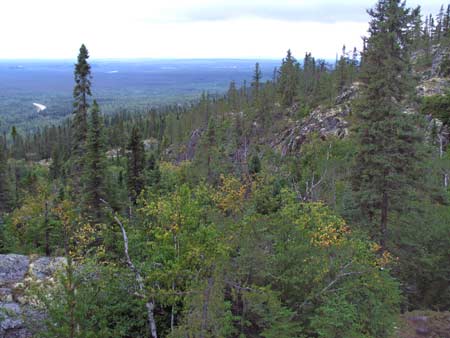
Km 10: Farther up
the trail passes through a quite different landscape
than lower down. Lichens, moss, spruce trees and rocks
dominate. |
|
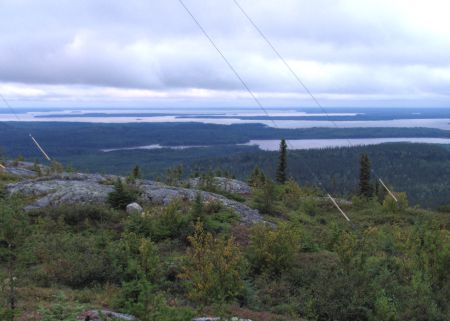 |
Km 10: The view
from the top, looking north. |
|
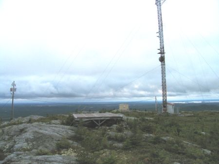 |
Km 10: The
microwave tower and helicopter landing pad at the top. |
|
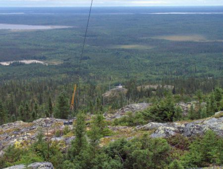 |
Km 10: Looking down
from the top to the pull-off along the Road where the
trail starts (it's the light spot in the center of the
photo). |
|
 |
Km 10: Looking
south along the James Bay Road. Matagami is visible in
the distance (but not in this photo). |
|
|
Km 12:
Second access point to the Mont Laurier hiking trail system. Park along
the road or drive in a short ways and park off to the side. No sign
along the road. |
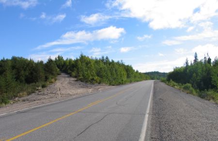 |
Km 18:
Here is the third access point to the
Mont Laurier trail
system.
The trail leads up the abandoned road seen on the far
side of the James Bay Road here. No sign along the
road. Park along the road. |
|
|
Page précédente
Page suivante |
|
|

